Five waterfronts, six hand-drawn maps, one question: what can we learn from each other in Europe in relation to climate change?
The Turning the Tide Atlas distils three years of fieldwork into a single publication. It brings together Gdańsk, Vienna, Evia, Stockholm and the Euregio Meuse-Rhine: places where climate change shows itself plainly, from rising seas and wildfires to floods and post-glacial rebound. Dr. Marlies Vermeulen and Remy Kroese from Dear Hunter conducted the fieldwork and crafted the atlas, with contributions from Dr. Liz Gardiner and Elisavet Papageorgiou and in consultation with the project partners and the more than 30 artists who conducted their own research within the framework of Turning the Tide.
What’s inside
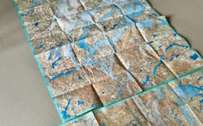
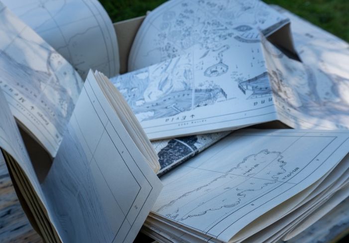
Five cartopological maps: a method merging cartography with anthropology. Six weeks of immersion per location, translated into hand-drawn maps of what was heard, seen and researched. Snowy summits sit beside local waters, ancient myths beside contemporary habits, historical ice sheets beside land that still lifts almost a centimetre a year.
At the centre sits the cross-section map, arranging all five locations against four themes so that patterns become visible which stay hidden when places are read alone. Where a stream forks and an island forms, a tension has reached its sharpest expression.
Alongside the maps come additional booklets, offering guidance in reading and interpreting them, insights from the research, and notes on impact, recommendations and lessons learnt.
Read across the five locations, the same concerns keep surfacing. Masterplans descend from above, while resilience grows from those who know the land by living on it. Urgency is unevenly distributed, and those who feel the consequences most acutely usually have the least power to shape the response. Landscapes are treated as scenic backdrop while behaving as dynamic systems. And infrastructure works at a distance, invisible until it fails: Green energy powers distant cities, iron ore mining sustains Stockholm’s comfort, Vienna’s taps forget the Alps. Where risk and benefit are separated, accountability dissolves.
The Atlas extends the project’s reach to readers beyond the partnership and presents its method in an artistic form that aims to inspire both artistic practitioners and policy makers.
Note on the digital edition
The full Turning the Tide Atlas is available to read online at no cost; however, its design is structured as a folding artifact intended for physical handling, so we warmly invite you to experience it in print whenever possible for the best encounter with its currents and connections.
A companion booklet contains all 42 artworks realised within the framework of Turning the Tide. These are accompanied by interviews with the artists, reflecting on their research, their project and the impact. This booklet can be consulted through the ‘Atlas’ page on the website of Turning the Tide, or directly through this link.
The Turning the Tide Atlas was created by the Turning the Tide partnership, edited and written by Dear Hunter (Dr. Marlies Vermeulen & Remy Kroese), with contributions from Dr. Liz Gardiner and Elisavet Papageorgiou. It is licensed under a Creative Commons Attribution-NonCommercial-ShareAlike 4.0 International licence (CC BY-NC-SA 4.0).
First edition of 100 numbered copies. Vaals, 2026